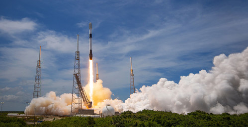
ICEYE successfully completes its largest satellite launch ever, placing five new SAR satellites into orbit

ICEYE, the global leader in persistent monitoring with radar satellite imaging and an expert in flood and natural catastrophe (NatCat) solutions, has successfully launched five new SAR satellites. All spacecraft were launched on SpaceX’s Falcon 9 smallsat rideshare mission via EXOLAUNCH from Cape Canaveral, Florida. Communication has successfully been established with each spacecraft. ICEYE and ICEYE US have now deployed 21 satellites since 2018, including both commercial and dedicated customer missions.

ICEYE’s satellite constellation is designed to provide customers with reliable and frequent imagery enabling the rapid detection and tracking of changes on the Earth’s surface, regardless of time of day, or weather conditions. This capability is vital for government and commercial uses in various sectors, including insurance, natural catastrophe response and recovery, national security, defense, humanitarian relief and climate change monitoring.
“The ICEYE team has launched 21 small radar imaging satellites in a few short years, which is a remarkable feat to accomplish,” says Rafal Modrzewski, CEO and Co-founder of ICEYE. “The world needs these sources of objective truth data now more than ever. With this launch, we’ll have increased performance and capacity to further support our customers and our growth across current and emerging vertical markets.”
The launch also included the second and third satellites built, licensed and operated by ICEYE US. ICEYE US, a subsidiary of ICEYE, established a satellite manufacturing facility early last year at its headquarters in Irvine, California. The newly launched ICEYE US satellites are licensed by the National Oceanic and Atmospheric Administration (NOAA) and will be operated and controlled exclusively from the company’s 24/7 Mission Operations Center in Irvine.
“Expanding our fleet of US built satellites is a critical step that expands our capability to support our customers across the U.S. Government,” says Jerry Welsh, CEO of ICEYE US. “We are seeing a shift in the U.S. and international government sector that is now looking to fully leverage and integrate commercial remote sensing technologies into their collection architectures.”
Two of the satellites launched are provided directly to the Brazilian Air Force. The Air Force will operate the satellites in support of environmental and national security objectives. Due to Brazil’s cloudy weather, SAR satellites that can image the earth during the night or through clouds have an important advantage in gathering actionable insights.
Later this year, ICEYE plans on adding up to five additional satellites to its constellation including more satellites manufactured by ICEYE US.
About ICEYE
ICEYE delivers unmatched persistent monitoring capabilities for any location on earth. Owning the world’s largest synthetic aperture radar constellation, the company enables objective, data-driven decisions for its customers in sectors such as insurance, natural catastrophe response and recovery, security, maritime monitoring and finance. ICEYE’s data can be collected day or night, and even through cloud cover. For more information, please visit www.iceye.com.


