
El Nino
-
NASA
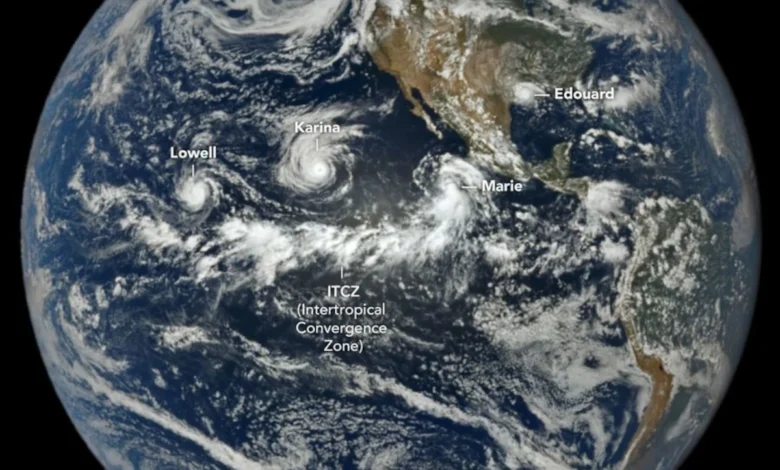
A Trio of Tropical Cyclones in the Pacific
When hurricane forecasters released their seasonal outlooks in spring 2026, the El Niño brewing in the Pacific contributed to predictions of below-normal activity in the Atlantic basin but above-normal activity in the northeastern and central Pacific basins. In early September, near the climatological peak of hurricane season, those spring outlooks were on target, with the eastern Pacific buzzing with activity and the Atlantic notably quiet. As of…
Read More » -
NASA
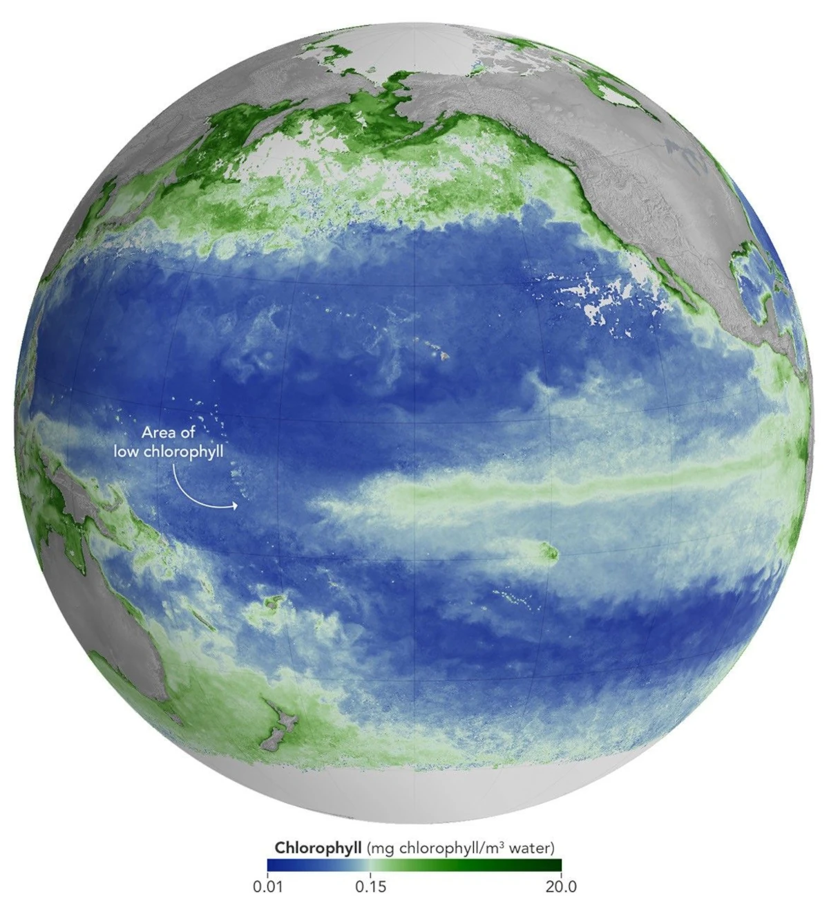
El Niño Alters Marine Life in the Pacific
As of June 2026, El Niño has officially arrived. This naturally recurring phenomenon is characterized by warmer-than-normal water temperatures in parts of the equatorial Pacific along with changes to atmospheric and oceanic circulation patterns. Its regional effects range from desert floods to delayed monsoons to shifts in where tropical cyclones are more likely to form. NOAA’s Climate Prediction Center expects the current El Niño…
Read More » -
NASA
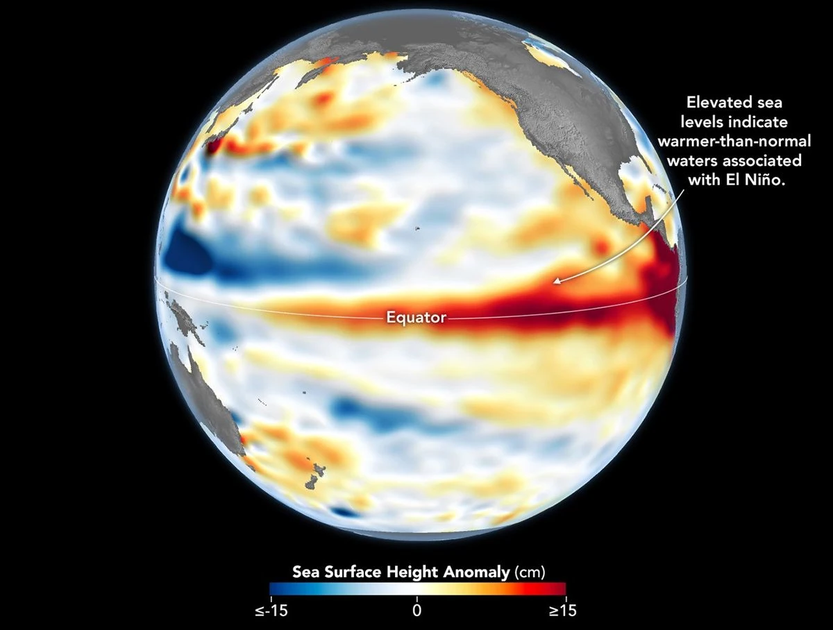
El Niño Is Underway
El Niño, characterized by warmer-than-normal water temperatures in parts of the equatorial Pacific, made its return in June 2026. Observations of sea surface height from the Sentinel-6 Michael Freilich satellite that month indicated that the 2026 event was continuing to strengthen. The natural, recurring phenomenon can have widespread effects, typically bringing wetter conditions to the U.S. Southwest and drought to countries…
Read More » -
NASA

International Sea Level Satellite Observes El Niño Precursor
International Sea Level Satellite Observes El Niño Precursor MP4 (1.10 MB) Description Sea level height data from the international Sentinel-6 Michael Freilich satellite collected from March to May 2026 show higher, warmer water moving from the western Pacific Ocean to just off the coast of Colombia, Ecuador, and Peru. This phenomenon is known as a warm Kelvin wave, signified in…
Read More » -
NASA
NASA-European Sea Level Mission Homes in on El Niño
Sea level data from a satellite launched by NASA and European partners shows that a swell of warm water hundreds of miles wide has arrived in the Pacific Ocean off the coast of South America, a sign that El Niño will likely emerge later in the year. Because water expands as it warms, a rise in elevation of an area…
Read More » -
NASA
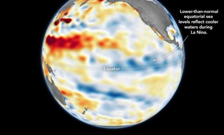
A Subtle Return of La Niña
After a several-month hiatus, La Niña returned to the equatorial Pacific Ocean in September 2025 and has continued into December. However, this occurrence of El Niño’s cooler counterpart is relatively weak, and its influence on weather and climate over the next several months remains to be seen. Part of the El Niño-Southern Oscillation (ENSO) cycle, La Niña develops when strengthened easterly trade winds intensify the…
Read More » -
NASA
How NASA Spotted El Niño Changing the Saltiness of Coastal Waters
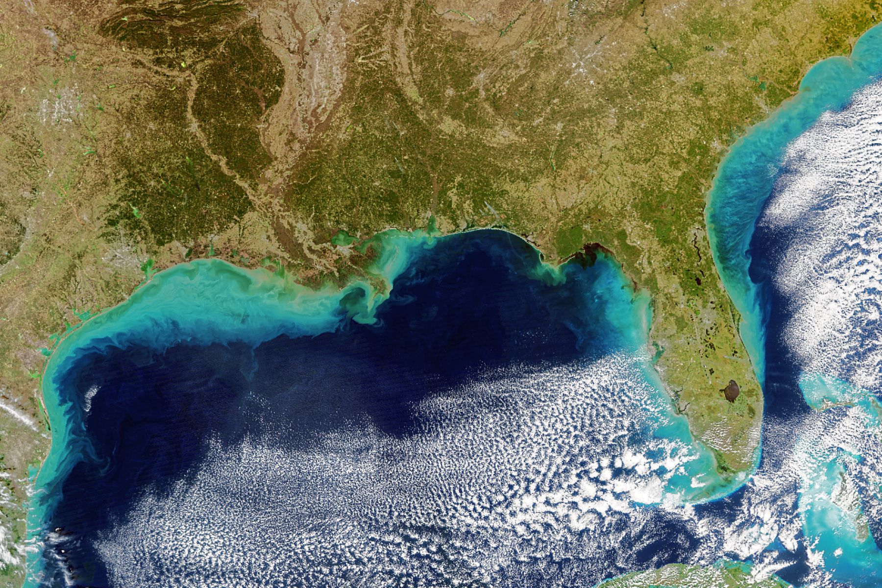
New findings have revealed a coastal realm highly sensitive to changes in runoff and rainfall on land. After helping stoke record heat in 2023 and drenching major swaths of the United States this winter, the current El Niño is losing steam this spring. Scientists have observed another way that the climate phenomenon can leave its mark on the planet: altering the chemistry…
Read More » -
NASA
NASA Analysis Finds Strong El Niño Could Bring Extra Floods This Winter
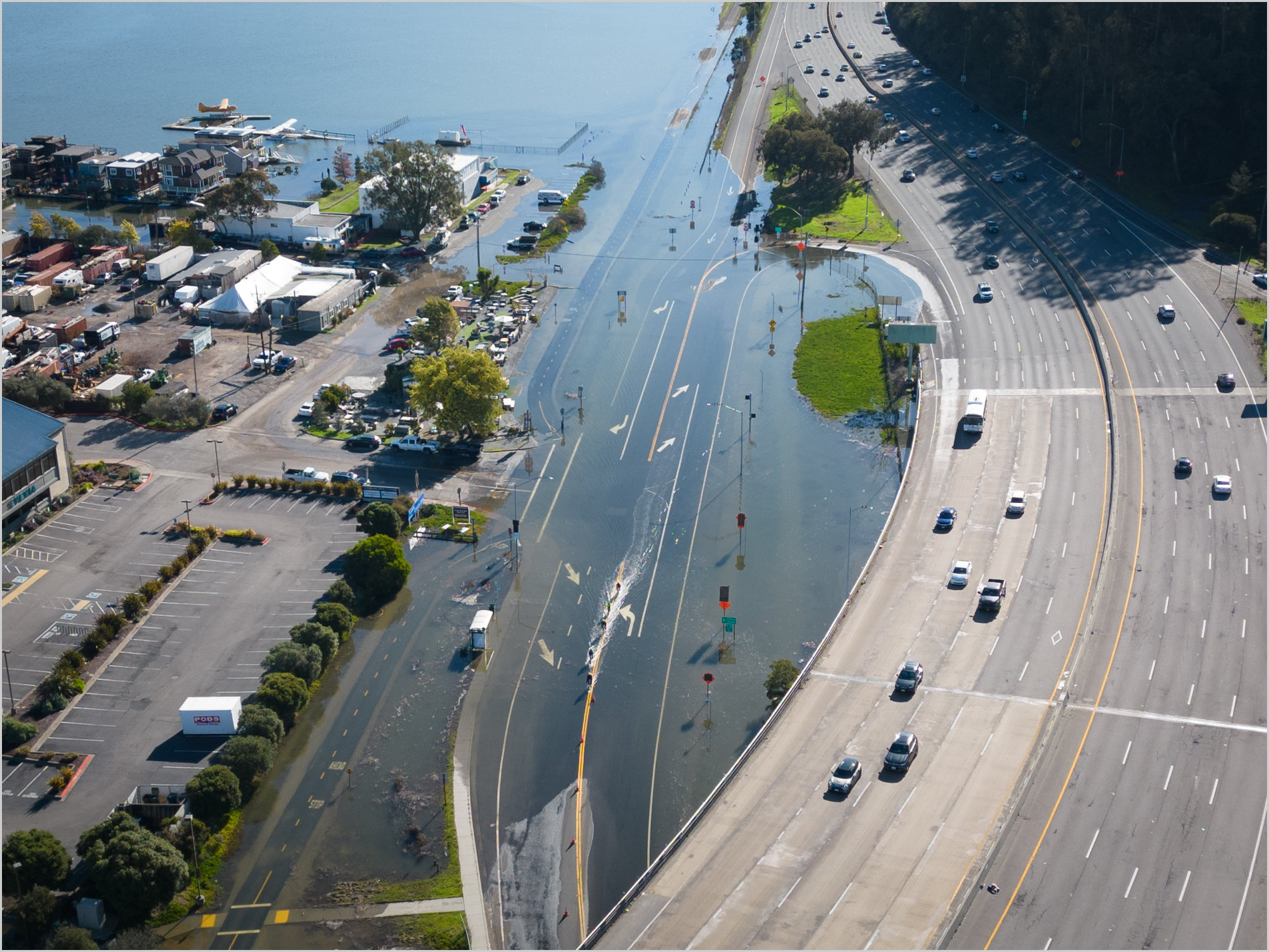
Such high-tide flooding that inundates roads and buildings along the west coast of the Americas tends to be uncommon outside of El Niño years, but that could change by the 2030s. An analysis by NASA’s sea level change science team finds that if a strong El Niño develops this winter, cities along the western coasts of the Americas could see an…
Read More » -
NASA
International Ocean Satellite Monitors How El Niño Is Shaping Up
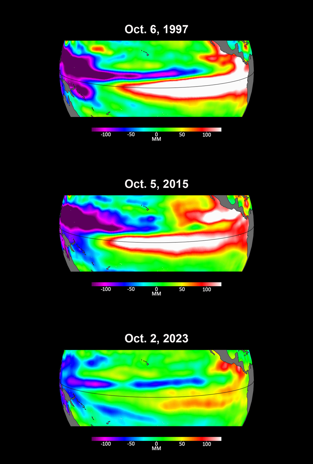
Sentinel-6 Michael Freilich is the latest satellite contributing to a 30-year sea level record that researchers are using to compare this year’s El Niño with those of the past. Not all El Niño events are created equal. Their impacts vary widely, and satellites like the U.S.-European Sentinel-6 Michael Freilich help anticipate those impacts on a global scale by tracking changes in sea surface height…
Read More » -
NASA
NASA Pinpoints Cause of Earth’s Recent Record Carbon Dioxide Spike
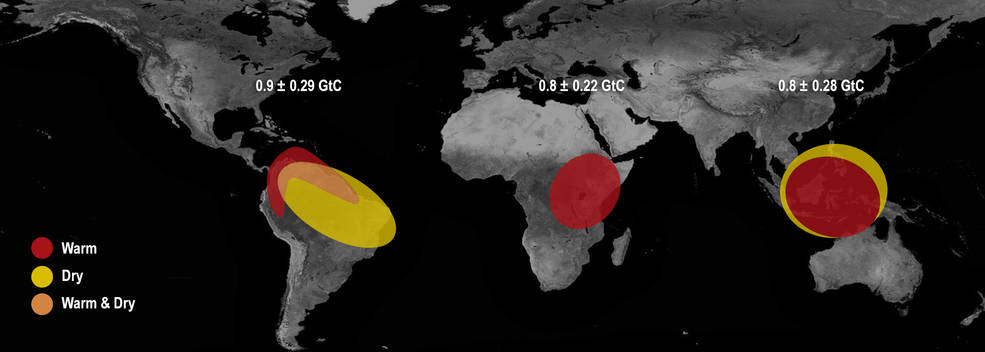
A new NASA study provides space-based evidence that Earth’s tropical regions were the cause of the largest annual increases in atmospheric carbon dioxide concentration seen in at least 2,000 years. Scientists suspected the 2015-16 El Nino — one of the largest on record — was responsible, but exactly how has been a subject of ongoing research. Analyzing the first 28…
Read More »