
MODIS
-
NASA
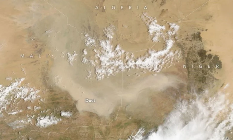
Dust Storm Sweeps Over Mali
As summer winds down in West Africa, so does much of the region’s dust activity. Dust storms can still occur, though, as one did in early September 2026, when a plume covered parts of Mali and neighboring countries. The MODIS (Moderate Resolution Imaging Spectroradiometer) on NASA’s Terra satellite captured this image on September 5, 2026. According to Tianle Yuan, an atmospheric scientist…
Read More » -
NASA
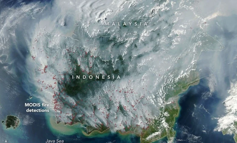
Peatland Fires Darken Skies in Indonesia
If there were an apex predator among fires, tropical peatland fires would be a top contender. These fires, which burn in dried wetland soils, are slow-burning, highly polluting, and notoriously difficult to extinguish because they smolder at low temperatures and often burn underground through expansive deposits of peat. By one estimate, peat fires generate three times more fine particulate matter than other tropical forest fires, five…
Read More » -
NASA
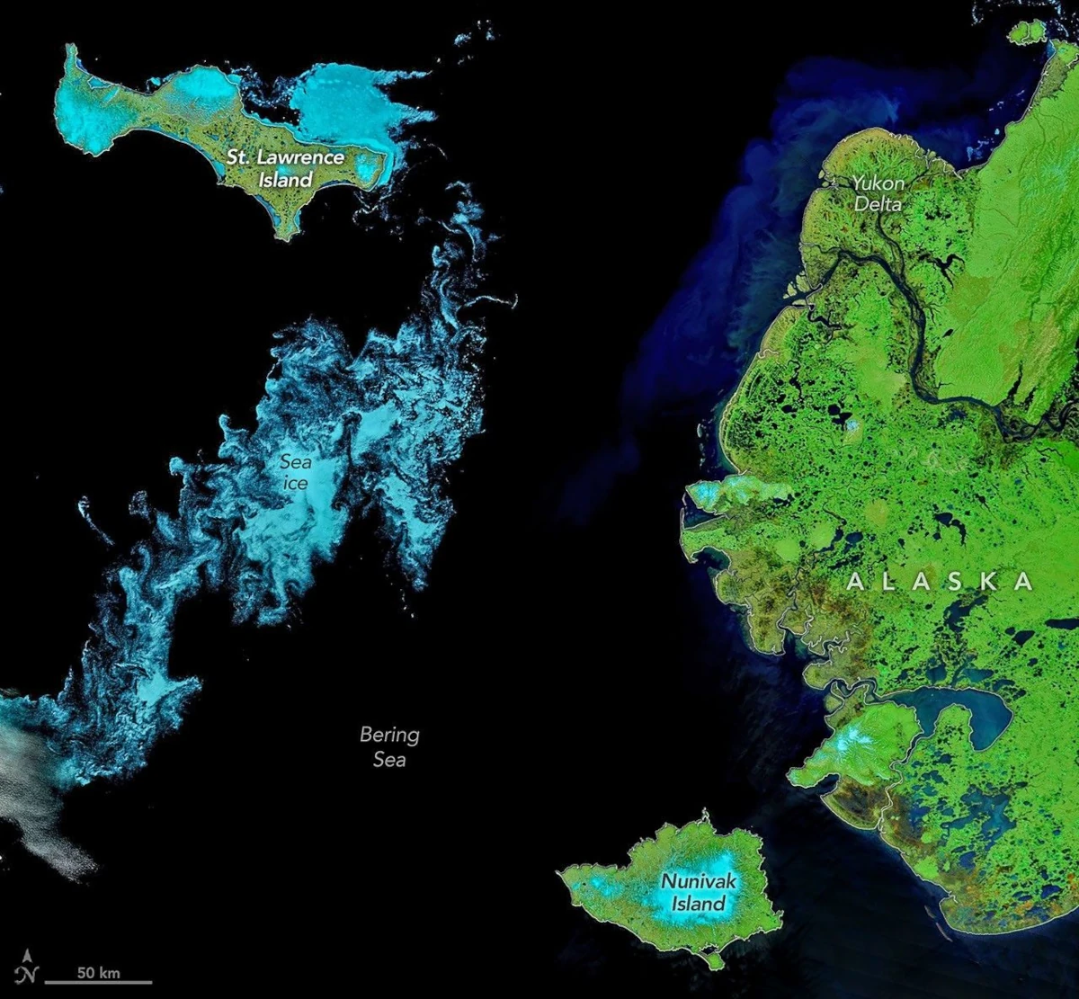
Signs of Thaw in the Bering Sea
When clouds parted in early June 2026, satellites glimpsed hints of summer’s approach in the Bering Sea off Alaska’s coast. Sea ice, broken into small fragments, took a few final spins on its way to melting completely, while rivers swollen with snowmelt washed sediment and organic material out to sea. These images, acquired with the MODIS (Moderate Resolution Imaging Spectroradiometer) on NASA’s Terra satellite…
Read More » -
NASA
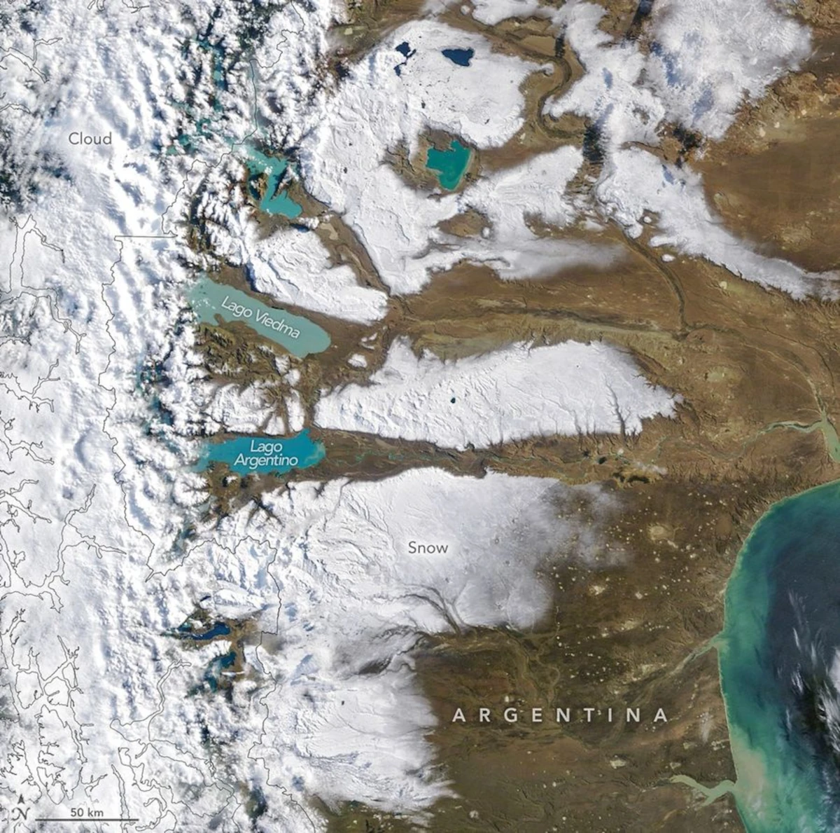
Snow in the Shadow of the Andes
On the eastern, arid side of the Andes, the plains of southern Argentina stretch from the mountains to the Atlantic coast. The landscape often appears dry and brown, interrupted by colorful glacier-fed lakes, but a storm in early April 2026 blanketed swaths of the land in white. The MODIS (Moderate Resolution Imaging Spectroradiometer) on NASA’s Terra satellite captured this image of the snowy Patagonian Desert…
Read More » -
NASA
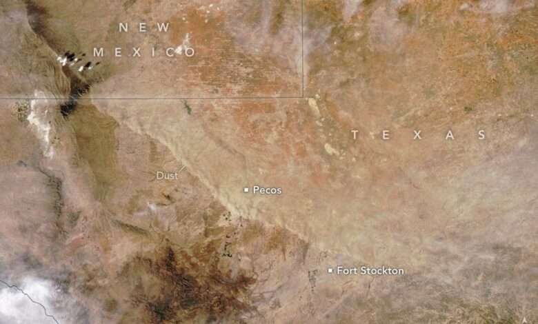
Wave of Dust Rolls Through Texas
The Ides of March brought perilous weather to West Texas and the state’s Panhandle. A strong cold front blasted south across the arid plains on March 15, 2026, bringing stiff winds that stirred up a curtain of dust. The cloud of suspended particles slashed visibility and made for treacherous travel as it swept across the region. The high winds, coupled with dry…
Read More » -
NASA
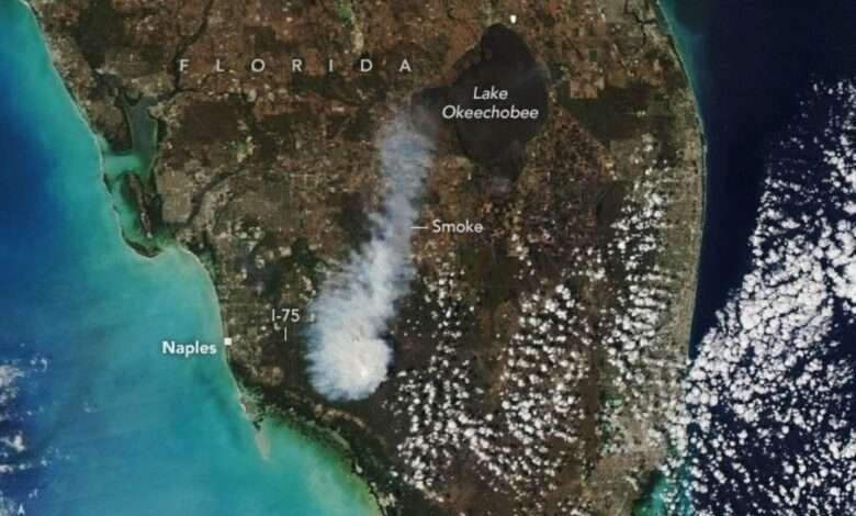
Smoke Rises Over Big Cypress National Preserve
On February 22, 2026, a wildland fire was discovered in Big Cypress National Preserve, about 25 miles (40 kilometers) east of Naples, Florida. The blaze, dubbed the National fire, moved through dry vegetation and sent a plume of smoke billowing over parts of the preserve and nearby communities. The MODIS (Moderate Resolution Imaging Spectroradiometer) on NASA’s Aqua satellite captured this image on the afternoon…
Read More » -
NASA
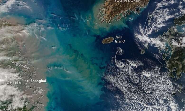
Showy Swirls Around Jeju Island
The tallest point in South Korea is not located in the Taebaek Mountains that run along the country’s eastern coast. Rather, it is found atop a volcanic peak on Jeju Island, about 100 kilometers (60 miles) south of the Korean Peninsula. In winter 2026, winds blew past the island in just the right way to send clouds spinning in its wake. The MODIS (Moderate Resolution…
Read More » -
NASA
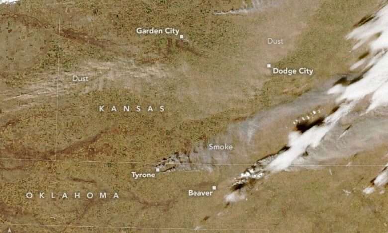
Winds Whip Up Fires and Dust on the Southern Plains
High winds coupled with dry conditions fueled fast-spreading wildland fires in the U.S. southern Plains in winter 2026. On February 17, several large blazes broke out on the Oklahoma Panhandle and burned quickly through tens of thousands of acres of grasslands and shrublands. The winds also caused dust storms and low visibility throughout the wider region. Smoke from multiple fires…
Read More » -
NASA
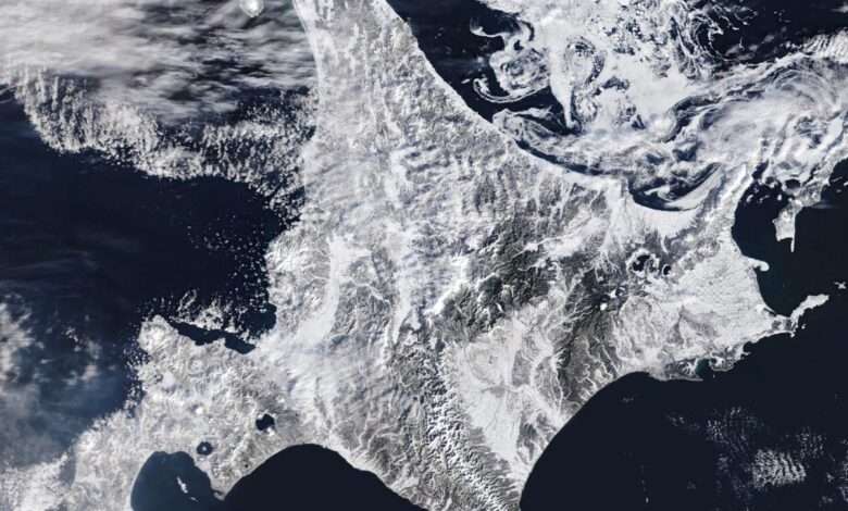
Stormy, Snowy Winter for Hokkaido
On February 5, 2026, the MODIS (Moderate Resolution Imaging Spectroradiometer) on NASA’s Terra satellite acquired this image of snow-covered landscapes across Hokkaido. With more than 31 active volcanoes, the island features several large caldera lakes, including at least five that are visible in the image. (Calderas are large depressions formed by volcanic eruptions.) In the east, forested windbreaks around Nakashibetsu form a checkerboard pattern, while to the…
Read More » -
NASA
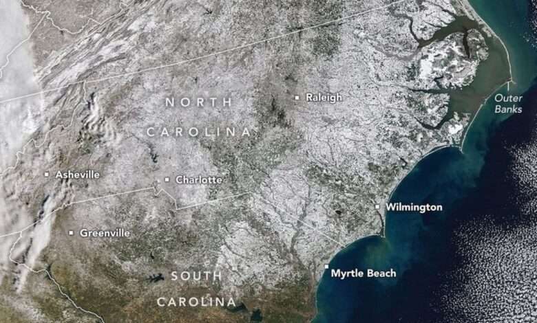
A Winter Blanket Covers North Carolina
A potent winter storm in late January 2026 left much of North Carolina dealing with significant snow accumulations. Though the state is no stranger to snow, such widespread coverage is unusual. This image, acquired on February 2 with the MODIS (Moderate Resolution Imaging Spectroradiometer) on NASA’s Terra satellite, reveals a nearly continuous blanket of white stretching from mountain cities in the west to beachfront towns…
Read More »