Earth planning date: Monday, Aug. 26, 2024
Today’s planning day was a good example of how our team comes together to make quick decisions based on new information and science priorities.
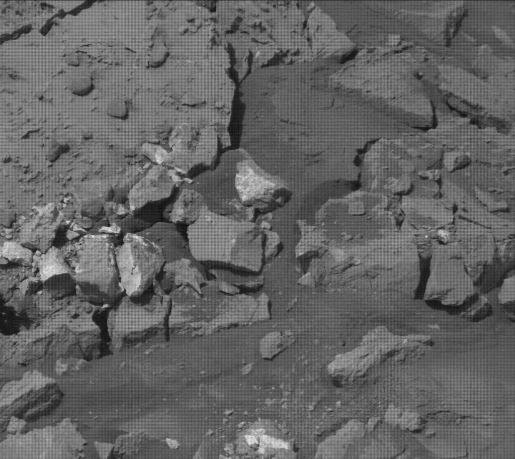
The original intent of today’s plan was to perform contact science on some interesting bright-toned rubbly rocks in our workspace, seen in the image above. These rocks were just a short bump away from the location of our last sampling campaign and the team had been eyeing them for a few weeks, interested in the details of their composition from the APXS instrument and their morphology from MAHLI. However, before we ever unstow our robotic arm to perform these types of observations, our Rover Planners and Surface Property Scientists perform a “Slip Risk Assessment.” This assessment is used to determine whether the rover’s wheels are stable on the ground so that we can safely unstow the heavy robotic arm and place the arm-mounted instruments very close to the surface. In today’s case, the team determined that it was not safe to unstow our arm. If the science team was interested in observing the bright-toned rocks in our workspace, it would require adjusting the rover’s position and performing the observations in the next planning cycle, impacting our overall mission timeline.
With this information on hand, the science team had an excellent discussion, quickly assessing the pros and cons of sticking around with a small adjustment to get contact science at this location in our next plan, or continuing down the road to our next waypoint. I always enjoy listening to these discussions; they are led by our Long-Term Planners and provide the opportunity for all science advocates to voice their opinions. In today’s case, the science team decided to move along. This location had been opportunistic to begin with and more juicy science targets are certainly to come. Time is a precious resource to us, and we often consider the timeline cost of any given science observation, weighing the relative science benefit to the cost of planning cycles.
So given this reworking of priorities, today’s two-sol plan was adjusted to include targeted science on the first sol before driving away towards our next waypoint, followed by another sol with untargeted science. Our drive takes us about 25 meters north and we’ll pause part way through the drive to take Mastcam imaging of some bright nodular-appearing rocks to examine their relationship to other rock types.
Between the two sols of this plan, we’ll perform an empty-cell analysis of the CheMin cell used for our last sampling campaign, to determine if we have dumped all the sample out of it for future use with another sampling campaign. As always, we performed our normal environmental monitoring observations.
Onward, Curiosity!
Written by Elena Amador-French, Science Operations Coordinator at NASA’s Jet Propulsion Laboratory