


NASA’s LRO Spots China’s Chang’e 6 Spacecraft on Lunar Far Side
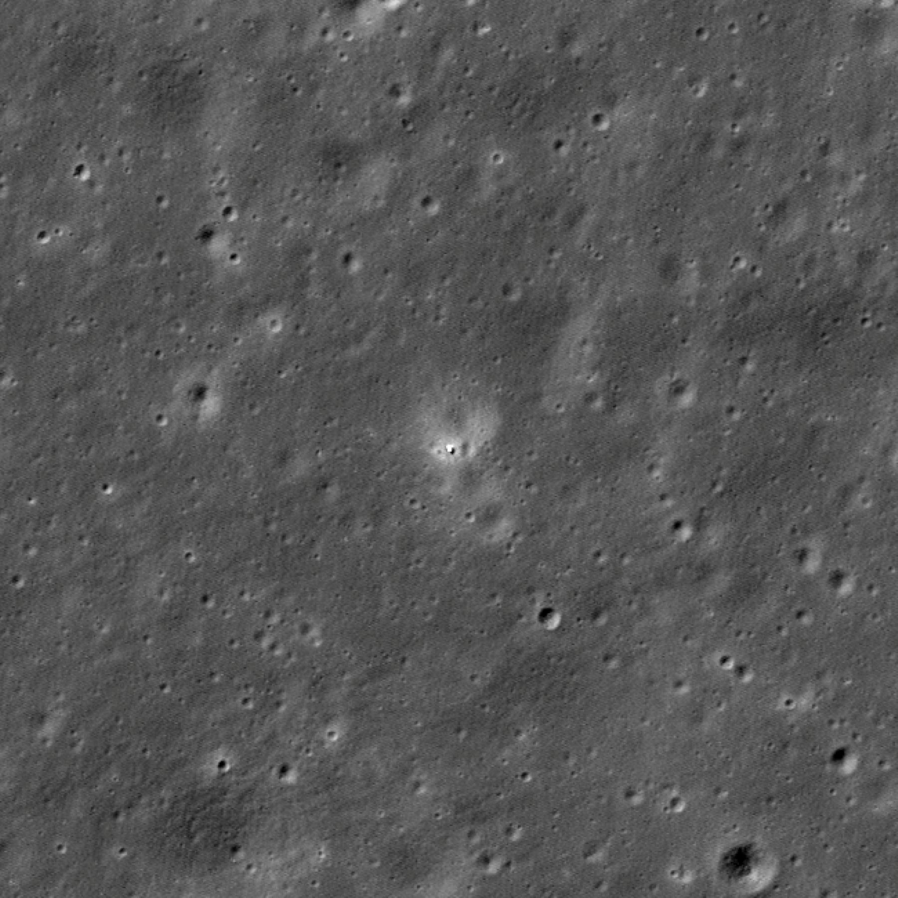
NASA’s LRO (Lunar Reconnaissance Orbiter) imaged China’s Chang’e 6 sample return spacecraft on the far side of the Moon on June 7. Chang’e 6 landed on June 1, and when LRO passed over the landing site almost a week later, it acquired an image showing the lander on the rim of an eroded, 55-yard-diameter (about 50 meters) crater.
The LRO Camera team computed the landing site coordinates as about 42 degrees south latitude, 206 degrees east longitude, at an elevation of about minus 3.27 miles (minus 5,256 meters).

This before and after animation of LRO images shows the appearance of the Chang’e 6 lander. The increased brightness of the terrain surrounding the lander is due to disturbance from the lander’s engines and is similar to the blast zone seen around other lunar landers. The before image is from March 3, 2022, and the after image is from June 7, 2024.
Credit: NASA/Goddard/Arizona State University
The Chang’e 6 landing site is situated toward the southern edge of the Apollo basin (about 306 miles or 492 km in diameter, centered at 36.1 degrees south latitude, 208.3 degrees east longitude). Basaltic lava erupted south of Chaffee S crater about 3.1 billion years ago and flowed downhill to the west until it encountered a local topographic high, likely related to a fault. Several wrinkle ridges in this region have deformed and raised the mare surface. The landing site sits about halfway between two of these prominent ridges. This basaltic flow also overlaps a slightly older flow (about 3.3 billion years old), visible further west, but the younger flow is distinct because it has higher iron oxide and titanium dioxide abundances.

A regional context map of the Chang’e 6 landing site. Color differences have been enhanced for clarity. The dark area is a basaltic mare deposit; bluer areas of the mare are higher-titanium flows. Contour lines marking 100-meter (about 328 feet) elevation intervals are overlaid to provide a sense of the topography. Image is about 118 miles (190 km) across.
Credit: NASA/Goddard/Arizona State University
LRO is managed by NASA’s Goddard Space Flight Center in Greenbelt, Maryland, for the Science Mission Directorate at NASA Headquarters in Washington. Launched on June 18, 2009, LRO has collected a treasure trove of data with its seven powerful instruments, making an invaluable contribution to our knowledge about the Moon. NASA is returning to the Moon with commercial and international partners to expand human presence in space and bring back new knowledge and opportunities.
More on this story from Arizona State University’s LRO Camera website
Got a Questions?
Find us on Socials or Contact us and we’ll get back to you as soon as possible.