




After a winter of below-average snowpack and an unusually warm and dry start to summer, the National Interagency Fire Center warned that the Great Basin and parts of the Rockies faced an elevated risk of wildfires in July 2026.
The warning proved accurate. By July 7, firefighters labored to contain nearly three dozen large, early-season wildland fires that raced through forests in several parts of the western U.S. Utah was among the most active states, with fires having charred 558 square miles (1,445 square kilometers) and four major fires that were not fully contained still burning.
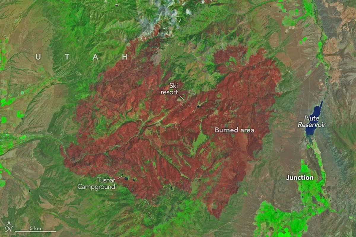
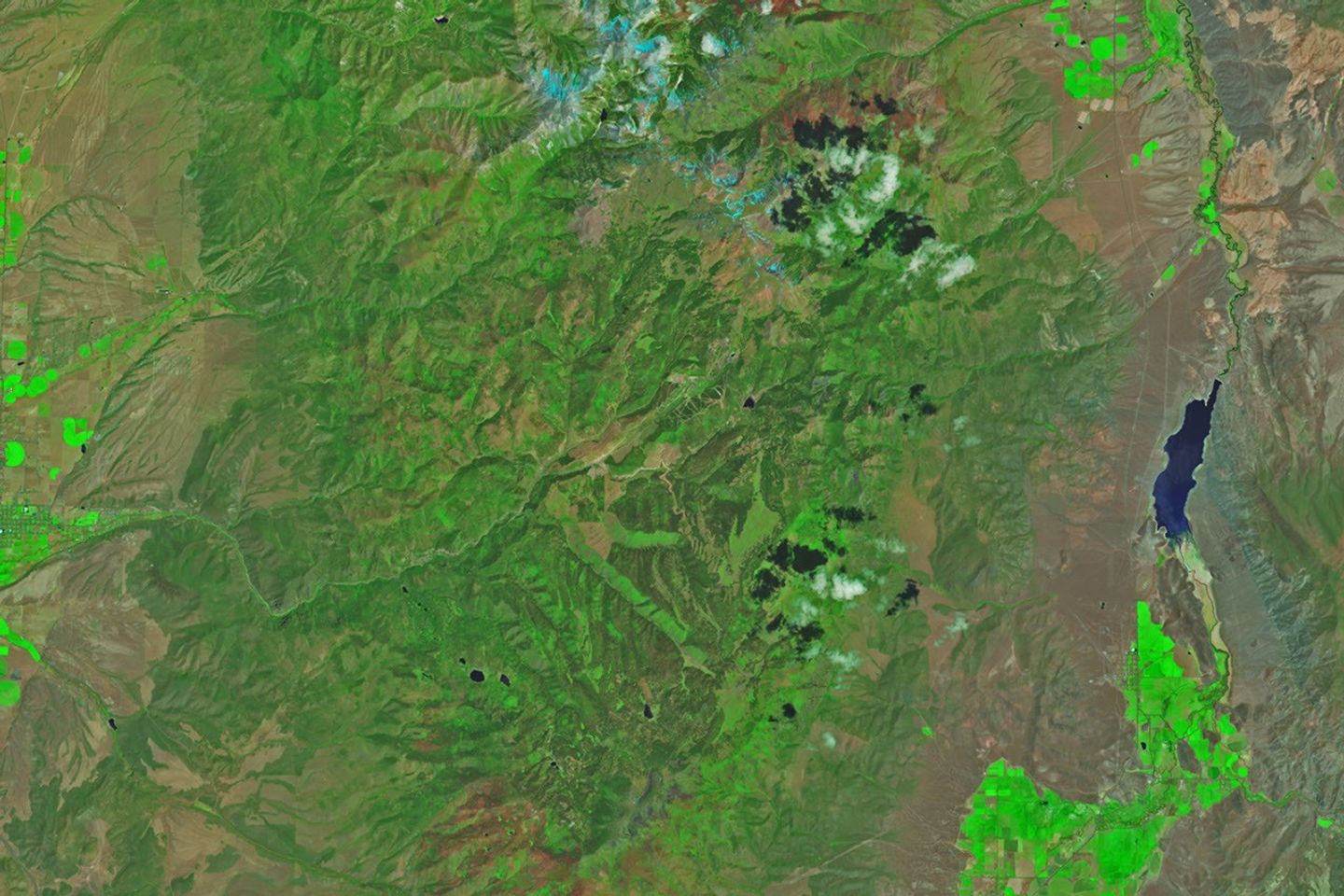
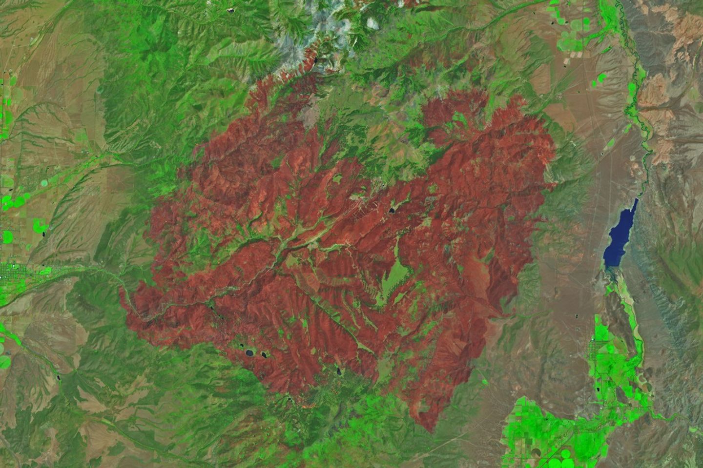
The Cottonwood fire ranked as one of Utah’s—and the country’s—largest and most destructive fires of the year so far. As of July 7, it had burned 150 square miles (390 square kilometers), just shy of the Babylon fire in eastern Utah. Landsat 9 captured the false-color image (bands 7-5-4) above (right) on June 29, 2026, when blackened vegetation spanned a large patch of rugged terrain along the Beaver River. The image on the left shows the same area on June 5, a few weeks before the fire ignited. In this band combination of shortwave infrared, near infrared, and visible light, unburned vegetation appears bright green, snow is blue, and clouds are white.
Ponderosa pine, oak, sagebrush, and grasses were among the vegetation types that burned. Officials with the state’s forestry division told news media that the Cottonwood fire had destroyed up to 150 structures. Eagle Point Ski Resort, which lost more than 100 condos and 30 cabins, also reported damage to four of its five chairlifts.
The damage to forests was extensive, though isolated patches survived largely unscathed, remaining as green oases within the broader burned area. Among them were the forests around Tushar Campground, the site of a 4-H summer camp. Beaver County officials credited years of forest treatments, such as clearing brush and trimming branches, with helping save the campground and surrounding forests.
Play Video
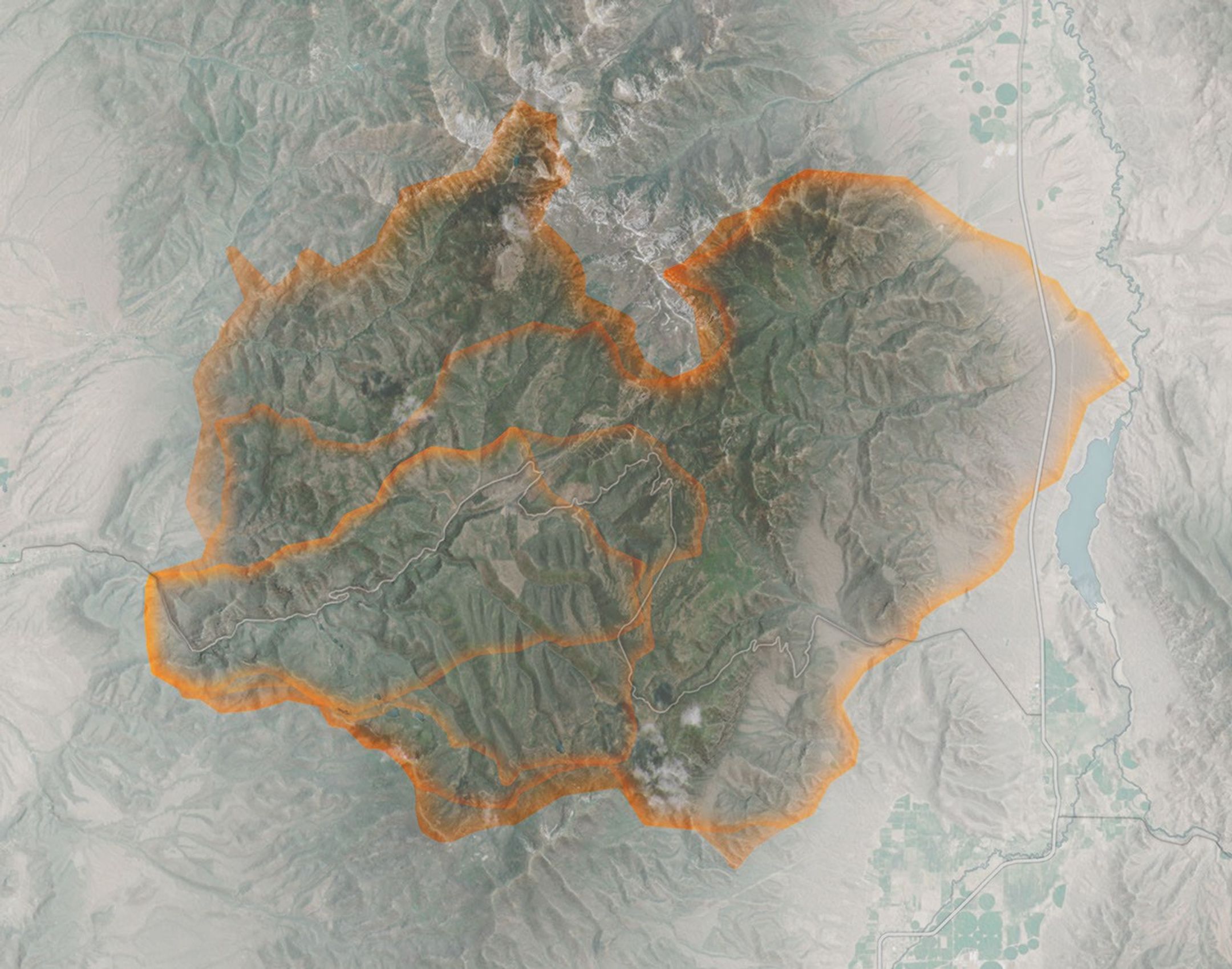
The fire spreads especially rapidly on June 23 and June 26. The fire perimeters in this visualization are based on data from NASA’s Fire Events Data Suite.
NASA Earth Observatory/Michala Garrison
As the fire spread, NASA’s Fire Events Data Suite (FEDS) tracked its progression and rate of growth. The visualization above, based on the FEDS system, shows the fire surging on June 23 and tripling in size over 12 hours that day as it spread to the north, east, and south. It also grew rapidly on June 26, when it made a run to the north. FEDS draws on data from the VIIRS (Visible Infrared Imaging Radiometer Suite) sensors aboard the Suomi NPP, NOAA-20, and NOAA-21 satellites, which detect active fires day and night by their thermal infrared signature.
FEDS is one of several tools available to firefighters and emergency management officials when responding to fires. First responders often rely on higher-resolution airborne imagers or on firefighters walking fire edges to map perimeters. FEDS offers a different advantage: consistent, easily accessible data that do not need to be specially requested, according to Tempest McCabe, a University of Maryland scientist based at NASA’s Goddard Space Flight Center who helped develop the tool. As a result, FEDS often detects a fire’s start earlier than other sources and tracks blazes for their full duration. To capitalize on strengths like these, the FEDS team is working closely with operational fire behavior analysts, with support from NASA’s FireSense program, to better understand and anticipate periods of rapid fire spread.
A total of 1,289 firefighters have been deployed to the Cottonwood fire, according to InciWeb, a website managed by the National Interagency Fire Center. As of July 7, the fire was 56 percent contained, but forecasters expect a hot, dry weather pattern to persist in the coming days, with fire behavior likely to be “very active to extreme” over the next 72 hours.
Government satellite data are part of a global system of observations used to track fire behavior and analyze emerging trends. Among the real-time wildfire monitoring tools that NASA makes available are FIRMS (Fire Information for Resource Management System), the Worldview browser, and the Fire Event Explorer.
As of July 7, 2026, fires had burned 5,265 square miles (13,636 square kilometers) across the United States, according to the National Interagency Fire Center. That’s 46 percent more than the 10-year average (2016-2025) for that point in the season.
NASA Earth Observatory images by Michala Garrison, using Landsat data from the U.S. Geological Survey and fire perimeter data from the Fire Events Data Suite. Story by Adam Voiland.
Downloads
June 5, 2026
JPEG (1.39 MB)
June 29, 2026
JPEG (1.41 MB)
FEDS fire perimeter (June 23-July 7)
JPEG (1.80 MB)
References & Resources
- 2KUTV (2026, July 6) Babylon Fire surpasses Cottonwood Fire as nation’s largest active wildfire. Accessed July 7, 2026.
- KSL.com (2026, July 2) Despite devastation, Cottonwood Fire leaves behind ‘islands of hope’ on Beaver Mountain. Accessed July 7, 2026.
- KUER (2026, July 6) Cottonwood Fire is yet another blow to ranchers in a tough year for rural Utah. Accessed July 7, 2026.
- NASA Earthdata (2026) Wildfires. Accessed July 7, 2026.
- National Interagency Fire Center (2026, July 6) National Fire News. Accessed July 7, 2026.
- National Interagency Fire Center (2026, July 6) Incident Management Situation Report Monday July 6. Accessed July 7, 2026.
- National Interagency Fire Center (2026, July 1) National Significant Wildland Fire Potential Outlook. Accessed July 7, 2026.
- The Salt Lake Tribune (2026, June 30) Eagle Point owner shares photos of resort charred by Cottonwood Fire. Accessed July 7, 2026.
- The Salt Lake Tribune (2026, June 30) Utah wildfires rank 1 and 2 as largest in the nation. Here’s the latest on big blazes. Accessed July 7, 2026.
- U.S. Drought Monitor (2026, June 30) Utah. Accessed July 7, 2026.
- Utah Fire Info Home (2026, July 7) 2026 Season Summary. Accessed July 7, 2026.
About The Author


Got a Questions?
Find us on Socials or Contact us and we’ll get back to you as soon as possible.