


A Winter Blanket Covers North Carolina
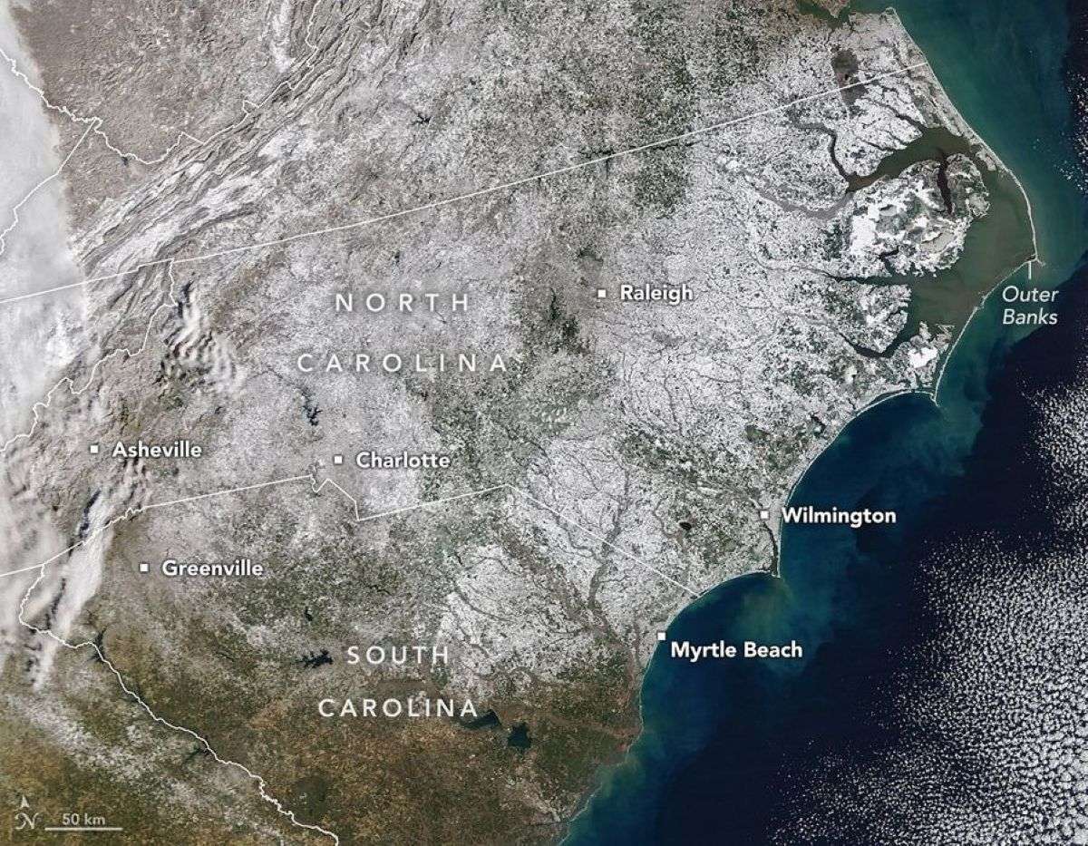
A potent winter storm in late January 2026 left much of North Carolina dealing with significant snow accumulations. Though the state is no stranger to snow, such widespread coverage is unusual.
This image, acquired on February 2 with the MODIS (Moderate Resolution Imaging Spectroradiometer) on NASA’s Terra satellite, reveals a nearly continuous blanket of white stretching from mountain cities in the west to beachfront towns in the east. According to the North Carolina State Climate Office, measurable snow fell in all 100 counties for the first time in more than a decade.
Snowfall in North Carolina typically requires cold air funneled in from the north to combine with moisture supplied by a low-pressure system. During the January 31 weekend event, Arctic air from earlier in the week lingered across the state as a storm approached along a near-shore track, setting the stage for widespread snow.
Snow totals exceeded a foot in some of the state’s western, mountainous regions, following several years without significant snowfall events, though some locations such as Asheville saw smaller amounts. The storm even pushed south into Greenville, South Carolina, in the foothills of the Blue Ridge Mountains, where the downtown area saw about 5 inches (13 centimeters) by the evening of January 31, according to the National Weather Service.
In the Piedmont region, the hilly central part of the state, Charlotte received nearly a foot of snow—the most since 2004—while Raleigh saw a lighter accumulation of 2.8 inches, according to the state climate center.
February 2, 2026
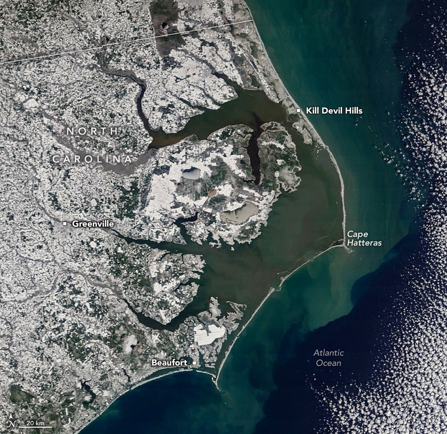
Even coastal parts of the state traded brown sandy beaches for a blanket of white, with more than a foot reported in parts of Carteret County. Beaufort, a mainland town in the southern Outer Banks area, experienced heavy blowing snow. Slightly inland, Greenville received 14 inches, an amount not seen since a large storm in March 1980.
Though appearing serene from space, the storm posed real hazards on the ground. Dangerous road conditions snarled traffic and caused collisions, according to local news reports, while coastal areas saw high winds and waves. Overwash on Highway 12 in the Outer Banks coated parts of the road in standing water and sand, while several homes along the shore of Hatteras Island collapsed into the sea.
NASA Earth Observatory images by Michala Garrison, using MODIS data from NASA EOSDIS LANCE and GIBS/Worldview. Story by Kathryn Hansen.
Got a Questions?
Find us on Socials or Contact us and we’ll get back to you as soon as possible.