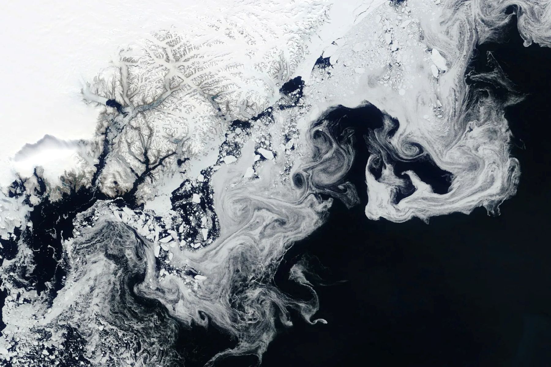
NASA’s Terra satellite captured floating fragments of sea ice as ocean currents carried them south along Greenland’s east coast on June 4, 2024.
This ice traveled from the Fram Strait, a 450-kilometer (280-mile)-wide passage between Greenland and Svalbard, to the Arctic Ocean. Along the journey, it breaks into smaller pieces and starts to melt in warmer ocean waters, creating the wispy patterns seen here.
Learn more about Arctic sea ice.
Image Credit: NASA/Wanmei Liang, using MODIS data from NASA EOSDIS LANCE and GIBS/Worldview
About The Author
I am the owner of Cerebral-overload.com and the Verizon Wireless Reviewer for Techburgh.com. My love of gadgets came from his lack of a Nintendo Game Boy when he was a child . I vowed from that day on to get his hands on as many tech products as possible. My approach to a review is to make it informative for the technofile while still making it understandable to everyone. Ben is a new voice in the tech industry and is looking to make a mark wherever he goes. When not reviewing products, I is also a 911 Telecommunicator just outside of Pittsburgh PA.
Twitter: @gizmoboaks
Like this:
Like Loading...
Related